


ISRO to launch five military satellites in 2019 to 'boost strategic assets' in space
ISRO hasn't attempted to launch more than two military satellite missions in a year so far.

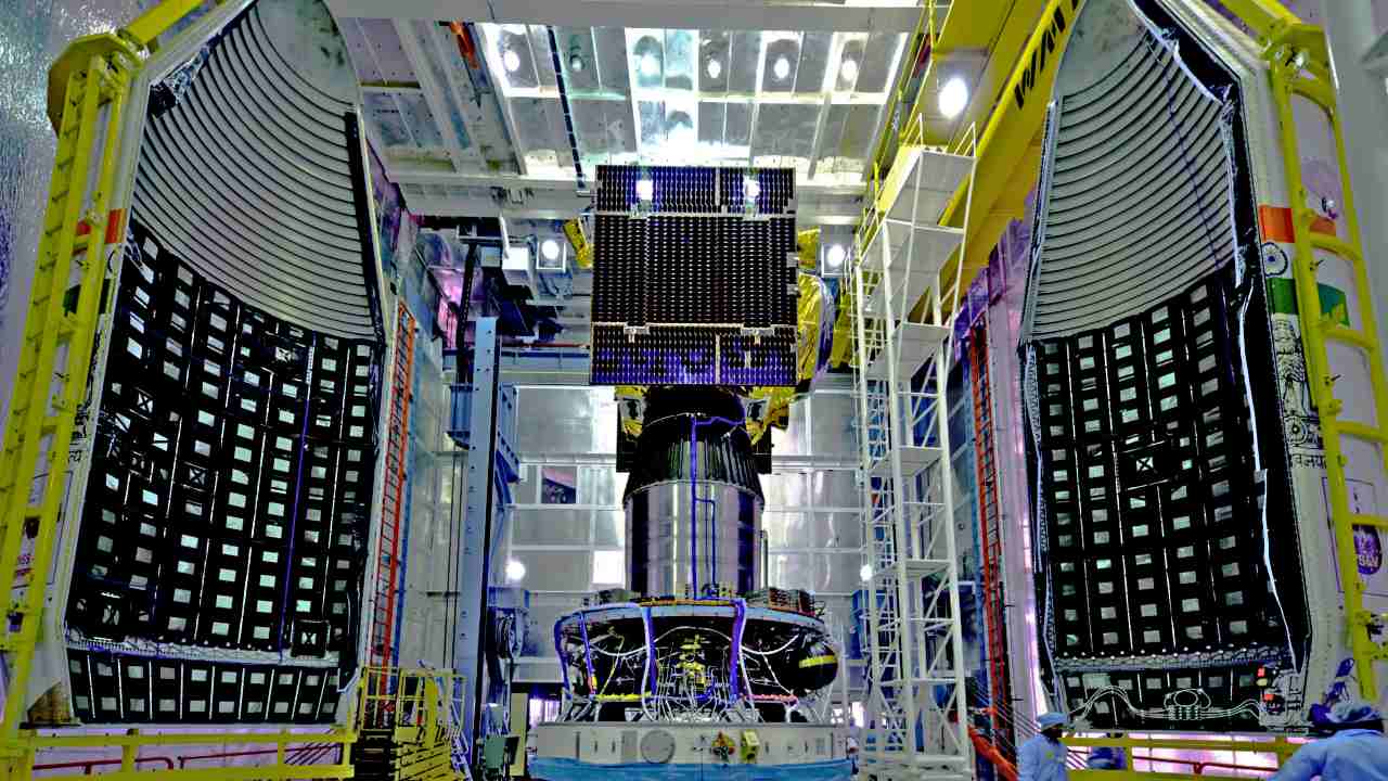
The IRNSS-1 satellite integrated with PSLV-C31 (centre) with two halves of the heat shield on either side. Image courtesy: ISRO[/caption]
ISRO's RISAT series and RISAT-3
Radar Imaging Satellite (RISAT) is a series of remote sensing satellites built and operated by ISRO.The launch of RISAT-1 came many years after the launch of its planned successor, RISAT-2, which had enhanced remote sensing capabilities courtesy of an Israeli-built X-band radar. The RISAT-2 mission and launch were prioritised over RISAT-1 after the 2008 Mumbai attacks, which delayed RISAT-1's launch by several years to 2012.RISAT-1 made a name for itself after images taken by the satellite were used to carry out the surgical strikes after the Uri attack in 2016 and, more recently, air strikes on the Jaish camp in Pakistan.Now, ISRO is building RISAT-2B, to be launched on the PSLV-C46 rocket in May, followed by the RISAT-2BR1 in July, RISAT-2BR2 in October and RISAT-1A in November this year.[caption id="attachment_6386291" align="aligncenter" width="640"]
RISAT-1 undergoing prelaunch tests at clean room in Sriharikota in 2009. Image: ISRO[/caption]
CartoSAT-3
CartoSAT-3 is third in a series of earth observation satellites built by ISRO. It is, however, a variant of its predecessors, built specifically for defence capabilities with advanced remote sensing tools. CartoSAT-3 will be a leap of advancement over CartoSAT-2, with far better spatial range and resolution, according to a report in The Hindu.CartoSAT-3 is one of the most advanced imaging satellites ever built by ISRO, capable of producing images considered the most high-resolution in the world. It will have powerful capabilities in multiple different spectra: panchromatic (captures all visible colours of light), multispectral (captures light within specific ranges in the electromagnetic spectrum) and hyperspectral (captures light from across the electromagnetic spectrum) earth observation mission, the Hindu report says.CartoSAT-3 will be launched in the PSLV-C47 mission this May.[caption id="attachment_5751061" align="alignnone" width="1280"]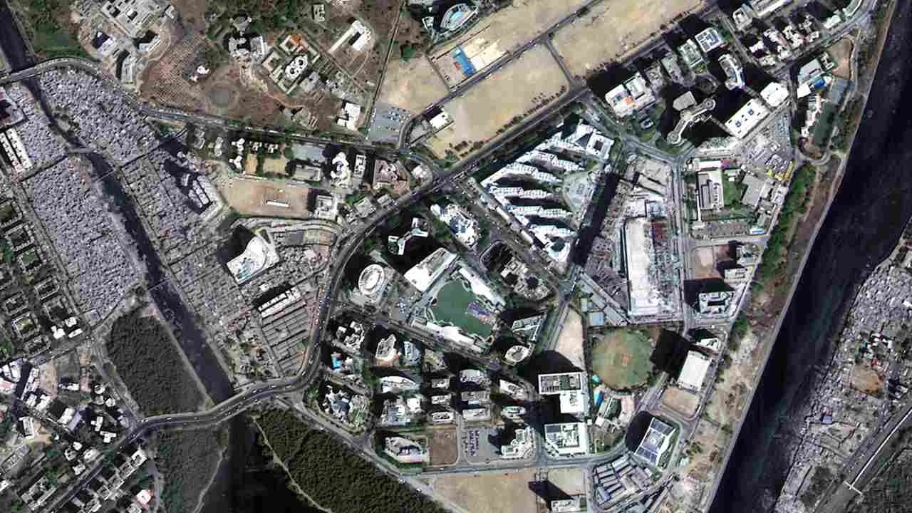
An image captured by Cartosat-2 of BKC and the Mithi River in Mumbai on 18 February 2017, its first day of operation. Image: ISRO[/caption]The speedy launch of five new satellite missions in the short span of one year hasn't been done before, and is part of a boost to defence assets amid heightened tensions along the Pakistan border and increased naval activity by China in the Indian Ocean, ToI reported.
ISRO's new GISAT series
Also planned for later in the year is the construction and launch of a brand new series of remote-sensing satellites, the Geo-Imaging Satellite (GISAT) series. GISAT carries imaging and radar tools to map land area in multiple wavelengths of light and resolutions.GISAT could be useful for purposes both military and civilian. Whereas so far, land mapping satellites could survey a specific area only once in 22 days, GISAT will speed that up monumentally by scanning and mapping any specified area every alternate day. It will provide live, real-time images of large areas of India if conditions are not cloudy.Other (non-military) ISRO missions planned this year are the Chandrayaan-2 launch and the first test demonstration of a new series of launch vehicles, a mini-PSLV rocket called the Small Sattelite Launch Vehicle (SSLV).

Careless Whispers: Scientists discover that plants can 'talk' to each other using smells
Life on Mars? European Space Agency’s Orbiter discovers ice water deposits at equator
Microsoft briefly overtakes Apple as the most valuable company, Apple back on top again
Even NASA is facing a tough time, starts layoffs following major budget cuts
ISRO, NASA's NISAR satellite to get ready by Jan-end, will monitor Earth's snow-covered regions