


NASA and USGS released the first photos of Earth captured by the Landsat 9 satellite
The satellite, along with its predecessor Landsat 8, will collect approximately 1,500 images daily of the Earth’s surface, and cover the globe every eight days.

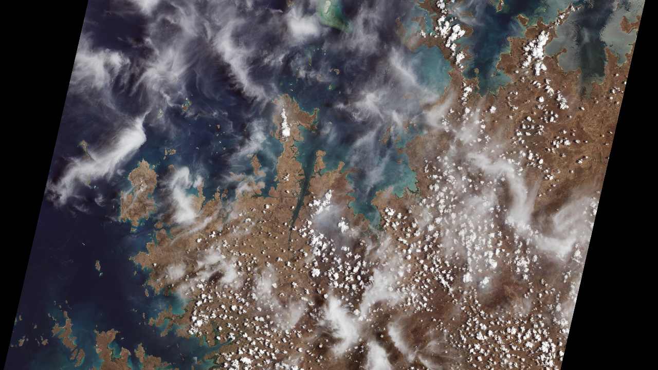
Mangroves are prominent along the northwest coast of Australia. The first image collected by Landsat 9, on Oct. 31, 2021, shows mangroves clustered in protected inlets and bays on the edge of the Indian Ocean. Fluffy cumulus clouds and high-altitude cirrus clouds hover nearby. The aqua colors of the shallow near-shore waters give way to the deep, dark blues of the ocean. Image Credits: NASA[/caption]The Landsat 9 has two Earth-imaging instruments, with one instrument, the Operational Land Imager 2 (OLI-2), picking up visible, shortwave-infrared and near-infrared light in nine different wavelengths. The other instrument, known as Thermal Infrared Sensor 2 (TIRS-2), is focused on detecting thermal radiation, which allows researchers to keep a track of the surface temperature.The satellite can also detect more subtle differences and transmit data with higher radiometric resolution to researchers. The Landsat can perceive differences between more than 16,000 shades of a given wavelength, according to NASA.The Landsat 9 team of NASA is conducting a 100-day check-out period which includes calibrating the satellite’s instruments and testing its systems and subsystems before handing over the mission to the USGS in January next year.The satellite, along with its predecessor Landsat 8, will collect approximately 1,500 images daily of the Earth’s surface, and cover the globe every eight days. The Landsat was launched in 2013 and remains in orbit to date.Bill Nelson, NASA administrator, said that the Landsat 9 program has the power to “save lives”. He added that the agency will continue to work with the USGS to “strengthen and improve accessibility to Landsat data” both in America and globally to help people gain a better understanding of the effects of climate change and to manage our natural resources more effectively.The Landsat programme has an unparalleled history of about 50 years in collecting data about the Earth from space. The first Landsat satellite was launched in the year 1972. With Landsat 6 being lost to a launch failure, the Landsat 9 is actually the eighth satellite in the program to reach orbit.

Careless Whispers: Scientists discover that plants can 'talk' to each other using smells
Life on Mars? European Space Agency’s Orbiter discovers ice water deposits at equator
Microsoft briefly overtakes Apple as the most valuable company, Apple back on top again
Even NASA is facing a tough time, starts layoffs following major budget cuts
ISRO, NASA's NISAR satellite to get ready by Jan-end, will monitor Earth's snow-covered regions