


China launches satellite to keep watch on its seas
China on Wednesday launched a high-resolution satellite for the protection of its maritime rights as the South China Sea dispute continues to simmer.

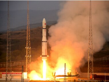
Representational image. Reuters[/caption]Gaofen-3, China's first SAR imaging satellite, will be used for disaster warning, weather forecasting, water resource assessments, and the protection of maritime rights, said state-run news agency Xinhua.China is locked in a maritime dispute with its neighbours over the South China Sea, which is believed to have large reserves of oil and gas. The Philippines, Vietnam, Brunei, Vietnam, Malaysia, and Taiwan have also staked claims in the waters.Though a UN-appointed Permanent Court of arbitration at The Hague rejected China's claims over the South China Sea in June, Beijing rejected the ruling, calling it "illegal".With 12 imaging modes, the high-definition observation satellite is capable of taking wide pictures of the Earth and photographing detailed scenarios of specific areas.Gaofen-3 is also China's first low orbit remote sensing satellite that has a lifespan of eight years. It is able to provide high-definition remote sensing data for its users over a long period of time.The Gaofen-3 and the Long March 4C rocket were developed by the China Academy of Space Technology and the Shanghai Academy of Spaceflight Technology, under the guidance of the China Aerospace Science and Technology Corporation.

India rejects Pakistan's 'baseless' claims at Asean, says Indus Waters Treaty to remain on hold
Indian trucker arrested in US over alleged theft of $3 million worth of tungsten powder
Austria turns Hitler’s birthplace into a police station 81 years after his death: 5 things to know
Nawaz Sharif wants to become prime minister of PoK — but laws framed by Pakistan disqualify him
Fake jobs, tourist visas: Inside Russia’s vast network luring foreigners to fight Ukraine war