


Indonesia's Krakatua volcano captured in satellite images shows collapse before tsunami
The challenge now is to interpret what might be happening inside it, and what next: Researcher.

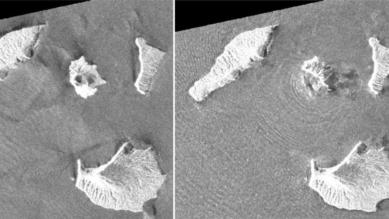
A combination of synthetic aperture radar images taken by JAXA's ALOS-2 satellite and analysis by Geospatial Information Authority of Japan shows Indonesia's Anak Krakatau volcano, center in images, before and after the 22 December eruption. The images were taken on 20 August, 2018, left, and on 24 December, 2018, right, respectively. The satellite imagery showed a deformation on the volcano's southwest side. AP[/caption]“The challenge now is to interpret what might be happening on the volcano, and what might happen next,” he wrote in a blog.Indonesian authorities are warning people to stay away a kilometer (less than a mile) from the Sunda Strait coastline because of the risk of another tsunami.JAXA’s post-eruption image shows concentric waves radiating from the island, which experts say is caused by ongoing eruptions.Anak Krakatau, which means child of Krakatau, is the offspring of the infamous Krakatau volcano that affected global climate with a massive eruption in 1883.Anak Krakatau first rose above sea level in 1929, according to Indonesia’s volcanology agency, and has been increasing its land mass since then.

Careless Whispers: Scientists discover that plants can 'talk' to each other using smells
Life on Mars? European Space Agency’s Orbiter discovers ice water deposits at equator
Microsoft briefly overtakes Apple as the most valuable company, Apple back on top again
Even NASA is facing a tough time, starts layoffs following major budget cuts
ISRO, NASA's NISAR satellite to get ready by Jan-end, will monitor Earth's snow-covered regions