


IIT Ropar and PEC University of Technology scientists develop new method to map glaciers
Retreat of glaciers is expected to increase the number of glacial lakes and also expand the size of existing ones, posing threats for catastrophic floods.

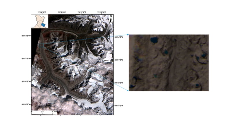
Satellite image of Gangotri glacier (with its location shown in the inset image). The zoomed-in view represents glacial lakes. India Science Wire[/caption]Scientists at the Indian Institute of Technology, Ropar and PEC University of Technology, Chandigarh have developed a new method to map glacial lakes with an accuracy of 85 percent.Its advantage is that it can help map even a glacial pond as small as 100 square meter with high precision. This is important as glacial lakes generally start as ponds known as supraglacial lakes (SGLs) and then grow in size with time. They form in the hollows on the glacial surface.Since water has lower albedo than ice, it absorbs more of the sun’s energy causing warming of the surface ice, which leads to increase in melting of glacial ice. The rates of ablation or removal of snow or ice from a glacier are typically one or two orders magnitude greater around SGLs than elsewhere.Traditionally SGLs are mapped through field surveys which are laborious, risky and time consuming. The new method maps SGLs by processing remote sensing data using a technique called Object-Based Image Analysis (OBIA) technique.“OBIA utilises spatial information parameters like image texture, contextual information, pixel proximity and geometric characteristics of ground objects. It provides a tool to work on different data sources collectively during mapping, weigh them based on their importance and segregate them based on spectral, contextual, and hierarchical criteria,” explained Dr Reetkamal Tiwari, visiting faculty at IIT Ropar and lead researcher, while speaking to India Science Wire.The researchers tested the new method to map SGLs in Gangotri glacier, using data from Indian Space Research Organisation (ISRO)’s Resourcesat-2 satellite. Dr. Tiwari said the method could be used to map and monitor other types of glacial lakes also such as moraine dammed lakes which too pose serious threats of flooding through sudden bursting.The study was funded by the Department of Science and Technology (DST). The research team included Kavita V. Mitkari and Manoj K. Arora of PEC University of Technology, besides Dr Tiwari. The study has been published in IEEE Journal of Selected Topics in Applied Earth Observations and Remote Sensing.India Science Wire

Why AI notetakers are raising serious privacy and security concerns
China's low-cost AI models are changing the global AI race. Here's why Silicon Valley is worried
China's Kimi K3 challenges US AI leaders with frontier-level performance at lower cost
How did Instagram run ads promoting child abuse in India?
Why has India halted WhatsApp’s username feature before launch?